Abercastle to Trefin
another Greenlives Walk - www.greenlives.org.uk/walk.html
Stage 21 OS Map of PCP Stage 22 Stage 23
Stage 22 ABERCASTLE to TREFIN (1st July 2016)
This a short (5 km) section to fit in with the 404 bus times, providing an easy half day walk.
After a zig-zag route from St. Davids, visiting various seaside villages en route the #404 bus dropped us off at the bridge at Abercastle just before 10am. This gave us plenty of time to walk the three miles along the Coast Path to Trefin, to catch the returning #404 just over two hours later.
Abercastle is another minute village at the head of a small harbour, wider than its neighbour Porthgain with more natural shelter from prevailing storms but also much less developed. The village has few public amenities (apart from the ever useful toilets). The bus stop is at the bridge in the village centre. Follow a narrow lane to the left of the river which heads towards the harbour. A beach of grey coarse sand is ahead with plenty of leaisure boats moored. There are public toilets behind a house on the left.
To the right of the harbour is a tall rocky outcrop, actually an island at high tide, Ynys y Castell. To the left, the path climbs at first gently but then more steeply to the plateau top. A path goes off left, to the Neolithic dolmen named Careg Samson (or the Longhouse). It is the remains of a neolithic chambered tomb, the covering earth mound having been removed to show a flat capstone resting on three supporting stones.
Back on the Coast Path our route crosses the head of an Iron Age promontory fort, Castell Coch. After this the path stays close to the cliff edge, sometimes with a dry stone wall with turf topping protecting the walker from disaster, sometimes not.
The field walls are a particular feature of this stretch. Made from large slate-based boulders with a course of narrower slates placed vertically on top with a capping turf layer. The turf has provided a home for wild flowers to flourish and there is a plentiful covering of thrift, sea pinks, foxgloves and many other species, making the walls extremely attractive. This is in contrast to the towering cliffs themselves, grey in colour and matching the cloud cover when we walked there. A sharp rain storm added to the sombre mood but after a few hundred yards the storm clouds were blown away Eastwards by a strong breeze, to be followed by sunny spells, in fact a typical Pembrokeshire summer day.
After Carreg Coch there is a sequence of three bays separated by small headlands. The cliffs here are more than 50 metres high and vertical, more impressive than the section to the West. The coast line is very crinkled here too, making the visible on the ground the abstract concept of fractals and self-similarity.
Above Pwll Olfa a footpath heads off left to the village of Trefin, across the top of the plateau. The Coast Path continues on the cliff edge, descending past some ruined slate-built buildings and turning inland to reach sea level at a bridge over a stream next to a ruined watermill Trefin Melin. There is a row of still inhabited cottages alongside and the path joins a road where the old mill leat crosses below it. The Coast Path continues along the road to the right but we turned left to take the steep climb up to the village of Trefin, home to the Mill Café and the Ship Inn.
The Strumble Shuttle goes through the village and can be hailed anywhere on its route but the official bus stop (with shelter) is further up the village street, just before a fork in the road. We caught the 12.14 bus back to St. Davids, just 35 minutes away.
Total distance walked 4.8km (3.0 miles) Ascent 220 m Time 1.5 hours.
The Pembrokeshire Coastal Path is one of the official UK National Trails, running from Amroth to St. Dogmaels, along clifftops, beaches and estuaries. The total length is 300 kilometres (185 miles).
You can download this route to your GPS or mobile phone by clicking on the 'View route..' link on the map below (provided you have registered (free) with ViewRanger
Get Ordnance Survey maps on your website to enhance the service and customer experience.
 Abereiddi beach
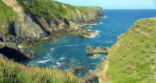 Cliffs near Cyfreddin
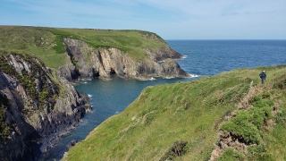 Aber Pwll
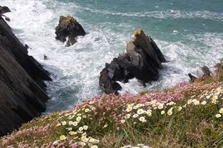 Point St. John
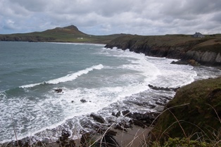 Porthselau cove
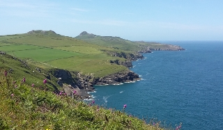 Carns towards St Davids Head
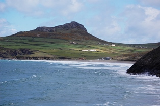 The peak of Carn Llidi
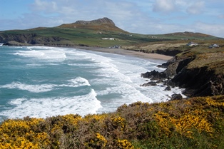 Whitesand Bay