OS Map of the walk
Use scroll and zoom buttons on map to move around.
Get Ordnance Survey maps on your website to enhance the service and customer experience.
Wimbledon Common & Richmond Park
Difficulty - Easy - Length - 12.2 km - Ascent - 141m
another Greenlives Walk - www.greenlives.org.uk/walk.html
Free - Hill Walks - Coastal Walks - History Walks - Country Walks - City Walks
OS Map of the walk
Get Ordnance Survey maps on your website to enhance the service and customer experience.
Photos by BadgerPerkins
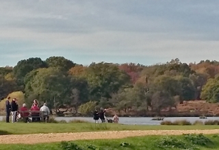 Pen Ponds in Richmond Park
 Alongside Sidmouth Wood
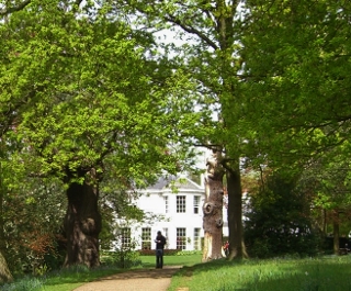 Approach to Pembroke Lodge
 Descent from Pembroke Lodge
 Ham House from the ferry
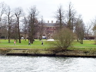
 Marble Hill House
GPX file: Click the boot to download a gpx file of this walk (track and waypoint info) Save to your gps device.
Location & Spoken Description
Many of the more recent Greenlives walks have a facility to show your present position on the live map. To find where you are just click on the button to the right of the map labelled 'Where am I?'.
Click here for your position.
You can also hear a spoken description of the entire walk by pressing the 'Play' button. When you've had enough, just press 'Stop'.
Click for walk description
If you have allowed your browser to send your location data the live map will centre itself where you are and a '0' marker will appear. Your positon on the map will be updated every few seconds and a new marker will be displayed.