OS Map of the walk
St. Margarets to Richmond Park circular walk
This walk leaves from St. Margarets station, crosses Marble Hill Park to the river Thames. A pedestrian ferry connects to the tow-path on the far side and a foot-path through Petersham enters Richmond Park. Climb up the hill to Pembroke Lodge (former home of philosopher and mathematician Bertrand Russell) then walk through the park to the gate at the top of Richmond Hill. Walk along the terrace before going down through a meadow to return to the riverside. Walk downstream through Richmond, past the White Cross pub, to Twickenham lock. Cross the river here and head back up river before returning to St. Margarets station.
Total distance 8 km (5 miles).
| No. | Eastings | Northings | Directions |
| 1 | 516800 | 174250 | Turn right out of St. Margarets station and go along Crown Rd. |
| 2 | 516900 | 173947 | At junction with Richmond Rd. turn left. Then cross zebra and enter Marble Hill Park |
| 3 | 517037 | 173877 | Follow tarmac path to playground then straight ahead to follow path going behind Marble Hill House. |
| 4 | 517320 | 173620 | At T-junction turn right and then ahead to river bank. Turn right and ahead to ferry. |
| 5 | 517300 | 173420 | Take ferry across river (60p single fare). On south bank follow tow path to left (down river) |
| 6 | 517845 | 173535 | At the slipway turn right up the road, away from the river. |
| 7 | 517980 | 173365 | After about 200m take a small lane on left between high walls |
| 8 | 518175 | 173445 | Follow the path to the right, where it joins a path across the field from the left. |
| 9 | 518180 | 173310 | At the T-junction with the main road turn left and cross road when safe to enter Richmond Park through iron gates. |
| 10 | 518290 | 173295 | From the gate take a path across the park to the east south east, heading up the hill. Aim for a small iron gate in a fence at the base of a small wood. |
| 11 | 518600 | 173185 | Follow the path uphill to the Mound. After admiring the view take the tarmac path to the right (i.e. to the east) |
| 12 | 518675 | 172950 | Pembroke Lodge provides a refreshment stop. Distance so far 4.0km |
| 13 | 518680 | 173050 | Leave Pembroke Lodge by the path you arrived on, past manicured flower beds and through a gate. |
| 14 | 518510 | 173730 | Leave the park and cross the main road, going right past the Star & Garter. Ahead along Richmond Terrace. |
| 15 | 518320 | 174010 | Just after the Roebuck pub turn left down the hill, across the open meadow. |
| 16 | 518135 | 173930 | Cross the main road at the bottom of the hill and turn right along the Thames towpath. |
| 17 | 517790 | 174545 | Continue along the tow path, under Richmond Bridge, then straight on past the White Cross pub. |
| 18 | 517340 | 174855 | Follow the tow path under the railway and road bridges as far as Richmond Lock. Cross the Thames here. |
| 19 | 516950 | 175020 | On the far side of the lock bridge turn left along the tow path and continue straight on under the road and rail bridges. |
| 20 | 517270 | 174740 | Immediately after the railway bridge turn right up a narrow footpath next to a fence. |
| 21 | 517115 | 174575 | Keep straight on where the path joins the road. |
| 22 | 517125 | 174220 | At the T-junction turn right and at the next T-junction with the main road turn right again. |
| 23 | 516855 | 174240 | Now you are back at St. Margaret's station |
Get Ordnance Survey maps on your website to enhance the service and customer experience.
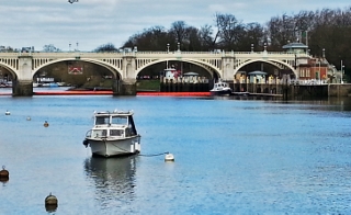
 Richmond Lock
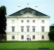
 Marble Hill House
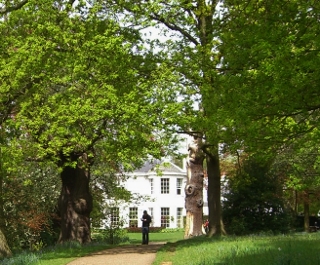
 Pembroke Lodge
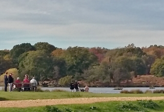
 Pen Ponds in Richmond Park