Get Ordnance Survey maps on your website to enhance the service and customer experience.
Ladybower and Win Hill
another Greenlives Walk - www.greenlives.org.uk/walk.html
Ladybower and Win Hill
another Greenlives Walk - www.greenlives.org.uk/walk.html
Get Ordnance Survey maps on your website to enhance the service and customer experience.
 Bamford station - start of walk
 POI 3. Turn right here
 Ladybower Reservoir
 Ashopston church spire
 Earth retaining wall of dam
 View north up the lake
 Conifer forest
 View across the lake
 Classic fly agaric toadstool
 Looking north from Win Hill
 Above and beyond Hope
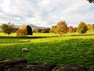
 Back in the valley
 End of the walk
GPX file: Click the boot to download a gpx file of this walk (track and waypoint info) Save to your gps device.
Location & Spoken Description
Many of the more recent Greenlives walks have a facility to show your present position on the live map. To find where you are just click on the button to the right of the map labelled 'Where am I?'.
Click here for your position.
You can also hear a spoken description of the entire walk by pressing the 'Play' button. When you've had enough, just press 'Stop'.
Click for walk description
If you have allowed your browser to send your location data the live map will centre itself where you are and a '0' marker will appear. Your positon on the map will be updated every few seconds and a new marker will be displayed.
A few of the most recent walks also provide audio description. After you have pressed the "Where am I?" button a voice will alert you as soon as you come close to any of the marked points of interest (provided your browser supports 'text-to-speech' and you have this function enabled).
You can repeat the spoken information about any of the points of interest by clicking on the 'speaker' icon next to all of the numbered markers on the path. Just press the 'Stop' button on the right hand panel to interrupt this before it ends.