The North Downs Way is one of the official UK National Trails, running from Farnham to Folkestone, following old routes and droveways along the chalk escarpment and ridges of the North Downs. The total length is just over 250 kilometres (160 miles).
The North Downs and South Downs are separate parallel chalk ridges running west to east and separated by around 50km. They are part of the chalk formation laid down in cretaceous period but uplifted probably as a side effect of the collision between what is now Italy and the western European landmass, which raised the Alps and a number of other geological features. The chalk top of the dome has been eroded, leaving parallel chalk ridges of the Downs, and exposed underlying Greensand ridges between a central Weald region. The rounded chalk hills are well drained and, as a result of extensive prehistoric clearances, excellent for walking. Both North and South Downs National Trails were put together from pre-existing drovers roads etc., animal movement tracks which took advantage of the drier more open hill tops for ease of transport.
The North Downs Way official site suggests a range, from easy walks (less than 5 miles) to challenging walks (more than 10 miles). We tend to go for shorter walks where the start and finish points are accessible by public transport. You can download a gpx track of each of our stages, to follow your own self-guided walk.
Details of our stages are given below, click on the Stage No. for a map and description. (This includes start and finish points, an estimate of the distance walked and the height climbed and, in some cases, where we stayed)Stage 1 - Farnham to Puttenham - 12.6km - 320m climbed
Stage 2 - Puttenham to Guildford - 9.6km - 280m climbed
Stage 3 - Guildford to Gomshall - 16.6km - 383m climbed
Stage 4 - Gomshall to Westhumble - 14.4km - 355m climbed
Stage 4a - Westhumble round trip - 10.0km - ???m climbed
Stage 5 - Boxhill to Reigate - 13.5km - 680m climbed
Stage 6 - Reigate to Merstham - 7.5km - 198m climbed
Stage 7 - Merstham to Oxted - 14.8km - 440m climbed
Stage 8 - Oxted to Betsom's Farm - 9.5km - 310m climbed
Stage 9 - Betsom's Farm to Dunton Green - 10.6km - 260m climbed
Stage 10 - Dunton Green to Wrotham - 14.1km - 358m climbed
Stage 11 - Wrotham to Harvel - 10.6km - 237m climbed
Stage 12 - Harvel to Rochester - 16.4km - 273m climbed
Stage 13 - Rochester to Bridgewood Manor - 11.76km - 385m climbed
Stage 14 - Bridgewood Manor to Bearsted - 16.32km - 672m climbed
Stage 15 - Bearsted to Harrietsham - 13.7km - 390m climbed
Stage 16 - Harrietsham to Charing - 11.86km - 180m climbed
Stage 17 - Charing to Wye - 11.5km - 195m climbed
Stage 18 - Wye to Chilham - 12.8km - 200m climbed
Stage 19 - Chilham to Canterbury - 14.3km - 284m climbed
Websites
Get Ordnance Survey maps on your website to enhance the service and customer experience.
Disclaimer: The author of these pages takes no responsibility for the accuracy of the directions given in the guided walks described here. Any walker following these directions does so entirely at their own risk.
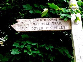 The Official Start of the North Downs Way
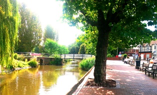 Dapdune Lock on the Wey at Guildford
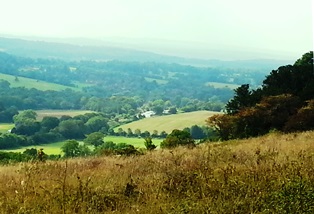 Tillingbourne valley
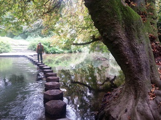 Stepping stones across the Mole River
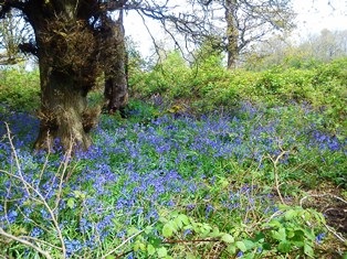 Bluebells on Reigate Hill